
Changing foliage each October transforms the valley and surrounding mountain ranges into an autumn wonderland of vibrant red, yellow, and orange.
Explore and experience the Shenandoah Valley’s beloved fall foliage on numerous trails and overlooks in Page Valley and Shenandoah National Park. With more than 500 miles of hiking trails to choose from, the possibilities are unbe-leaf-able.
Featured below are five fall hikes to get the season started, for any type of hiker.
SHORT AND SCENIC: Stony Man
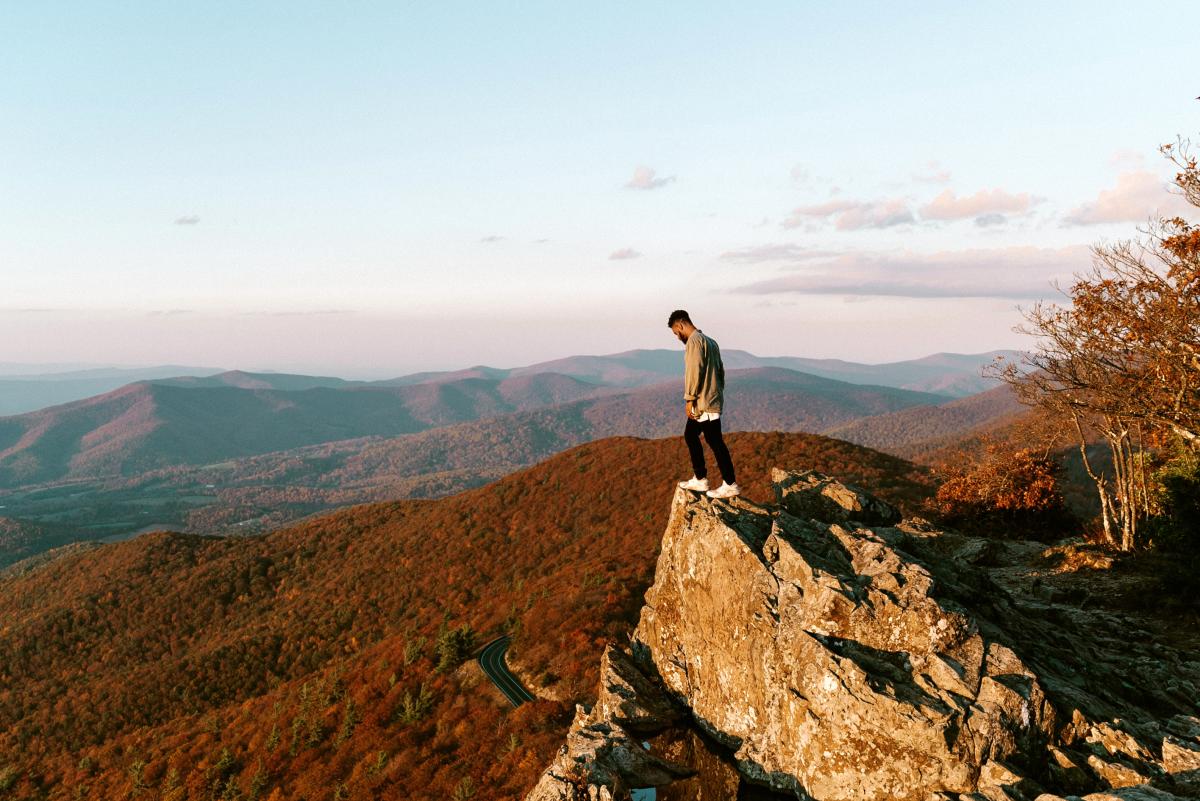
photo / virginia.org
Location: Mile 41.7 of Skyline Drive, Shenandoah National Park
Distance: 1.6-mile round trip hike
Difficulty: Easiest
Hiking Time: 1-2 hours
Elevation Gain: 340 feet
Pets Allowed: No
Featuring the second-highest point in Shenandoah National Park (4,011 feet), Stony Man’s peak looks out on a sweeping view of the Shenandoah Valley, the Town of Luray, and the Blue Ridge Mountains extending into the distance.
A stunning spot for sunset with a panoramic view spanning more than 180 degrees, the trail is a year-round favorite for many park visitors, in part because of its proximity to Skyland. We recommend grabbing dinner before or after or sunset hike — or savoring a piece of Skyland’s famous mile-high blackberry ice cream pie.
A SLOWER PACE: Lake Arrowhead
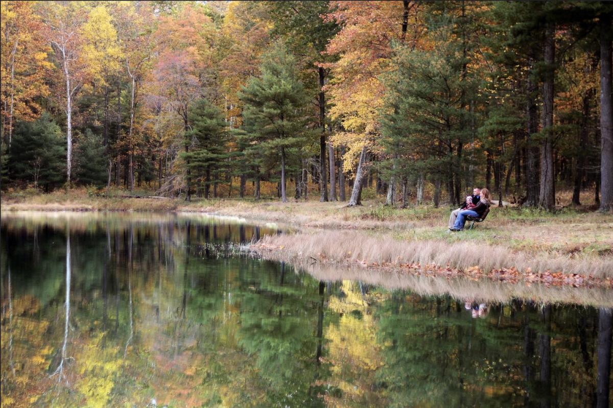
photo / R.T.Armstrong
Location: 265 Lake Arrowhead Rd., Luray, VA
Distance: 1.4-mile trail circling the lake
Difficulty: Easiest
Hiking Time: 30 minutes-1 hour
Elevation Gain: 114 feet
Pets Allowed: Yes, must be on a leash.
Situated at the foot of the Blue Ridge Mountains and offering a magnificent view of Page Valley, Luray’s Lake Arrowhead is heralded as a hidden gem for locals and returning visitors.
A 1.4-mile trail circling the lake showcases stunning foliage, wildlife, quaint fishing spots, and quiet resting places. Sunsets illuminate the lake and its surrounding beauty, with autumn colors and changing skies often reflected in the water.
ADA-ACCESSIBLE: Limberlost
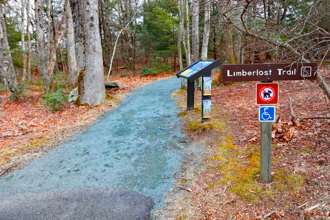
photo / NPS
Location: Mile 43 of Skyline Drive, Shenandoah National Park
Distance: 1.3-mile round trip hike
Difficulty: Easiest
Hiking Time: 1 hour, 30 minutes
Elevation Gain: 130 feet
Pets Allowed: Although pets are not allowed, service animals are welcome.
A popular trail for birding, Limberlost is a fully accessible trail. The hike is also a designated TRACK Trail, featuring a self-guided brochure and informational sign geared toward kids of all ages.
Winding through sprawling mountain laurels, tall oaks, and feathery ferns, the gentle trail showcases signs of each season year-round.
Accessibility Information
Length: 2338.3 yards/2138.1 meters • Surface Type: primarily crushed greenstone
Typical Tread Width: 5 feet/1.5 meters • Minimum Tread • Width: 2.7 feet/.8 meters
Typical Running Slope: 3.5% • Maximum Running Slope: 10.3%
Typical Cross Slope: 1.6% •Maximum Cross Slope: 5.0%
PANORAMIC PEAK: Old Rag Summit via Berry Hollow
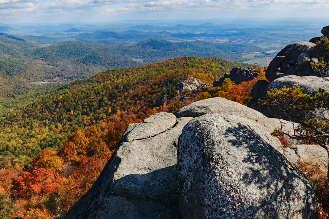
photo / NPS
Location: Central District, Shenandoah National Park
Distance: 5.4-mile roundtrip hike
Difficulty: Strenuous
Hiking Time: 6-7 hours
Elevation Gain: 1,760 feet
Activity Fee: Yes
Reservations: Yes
Pets Allowed: No
This SNP favorite is a strenuous hike but delivers sweeping views. This route to Old Rag begins at the Berry Hollow parking area and allows hikers to reach the summit without having to navigate the trail’s famous rock scramble. Even without the scramble, however, the hike is physically demanding and can be dangerous if you have not planned properly.
Along the strenuous trail, feel your stress fall away with each step of your ascent toward a peak looking out on a swirling sea of golden hues.
FAMILY FAVORITE: Whiteoak Falls (Lower)
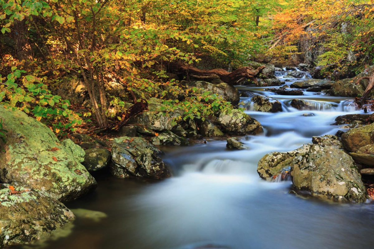
photo / NPS
Location: Central District (Park Boundary)
Distance: 2-mile roundtrip
Difficulty: Easiest
Hiking Time: 1 hour, 30 minutes
Elevation Gain: 500 feet
Pets Allowed: Yes, must be on a leash.
An easier hike to the base of the beautiful cascades and lower falls in Whiteoak Canyon, this hike takes nature lovers of all ages across a small stream with a return hike along the same route.
Looking for more to explore?
Raise your sights to Skyline Drive, an epic road trip destination. With 75 overlooks, 500 miles of hiking trails, dozens of waterfalls, and endless wildlife viewing opportunities — the drive provides outstanding views to the west overlooking the Shenandoah Valley and to the east into the Piedmont region. Shenandoah National Park is divided into three districts (north, central, and south), which makes for a perfect way to plan some easy, fun, and family-tested road trips. Visit Skyline Drive has several self-driving itineraries to get you started on your next adventure!

