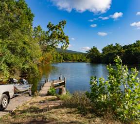
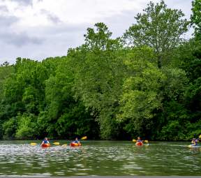
Whether it’s by tube, kayak, or canoe, we’ve got float trip recommendations for you on the South Fork of the Shenandoah River in Page Valley.
See the signs of the season and sweeping mountain views from the middle of the river. Soak up the sunshine, paddle through warm waters, and breathe in the fresh-air surroundings.
Keep reading to learn more about Page Valley float trips on the South Fork.
Note: Float descriptions are based on normal river flow conditions. Due to changes in water level and flow, difficulty and safety considerations may vary.
Shenandoah to Grove Hill
Distance: 8 miles
Map
Access the river at the Allegheny Power “hand-launch” access site directly below the Shenandoah Dam. People launching canoes or kayaks at this site will have to park their vehicles upstream of the dam at the parking area provided at the Town of Shenandoah/Virginia Department of Wildlife Resources (DWR) access site. Takeout at the DWR dirt ramp on the right at Route 650, just downstream of the U.S. 340 bridge.
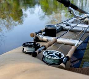
The river is accessible only to canoes and kayaks at the location. This is an easy float mixed with flat stretches and Class I rapids. This stretch has numerous smallmouth bass, rock bass, redbreast sunfish, musky, channel catfish, and in the slower reaches, largemouth bass and bluegill.
Grove Hill to Newport
Distance: 6 miles
Map
Access is at a DWR ramp located on Route 650 near Grove Hill. The takeout is on the left, downstream from Newport on U.S. 340. Both access sites are dirt and are not accessible to trailers.
This section of South Fork is comprised of several large pools and allows the angler a chance to fish for muskellunge, largemouth and smallmouth bass, bluegill, redbreast sunfish, and channel catfish.
CAUTION: Be aware that halfway to the Newport Access there is a large hydroelectric dam. Boaters can legally portage around the dam on the right side of the dam facing downstream.
Newport to Alma
Distance: 3 miles
Map
Launch at the DWR ramp located north of Newport on U.S. 340 and take out on the right side of the river, upstream of the U.S. 340 bridge at Alma. Both access points are primitive and not recommended for trailers. This section is riddled with Class I riffles and runs which provide for quality smallmouth bass and rock bass fishing.
Alma to White House
Distance: 7 miles
Map
The DWR access site at Alma is located just upstream from the U.S. 340 bridge on the right side of the river. The takeout is downstream of the U.S. 211 bridge on the right bank and can be accessed by Route 646.
This stretch has a diversity of habitat — pools, runs, and riffles that provide angling opportunities for smallmouth bass, rock bass, muskellunge, sunfish, and channel catfish.
White House to Massanutten
Distance: 4 miles
Map
The DWR ramp at White House can be accessed from U.S. 211 by taking Route 646. The takeout at Massanutten is on the left bank of the river and can be reached from Route 615. Both ramps are concrete and can be utilized by trailers.
The South Fork in this stretch is characterized by large pools which provide excellent musky habitat. Largemouth bass, bluegill, and channel catfish may also be found in the deeper pools, while smallmouth bass and rock bass may provide action in the riffle and transition areas.
Massanutten to Inskeep
Distance: 3 miles
Map
The Massanutten DWR ramp can be reached from Route 615. The takeout at Inskeep can be reached off Route 675, downstream of the bridge on the left bank. Trailers cannot access the Inskeep ramp. This float has a dam that must be portaged halfway through the float.
This section of river has many pools and provides excellent muskellunge, largemouth bass, and smallmouth bass habitat.
Inskeep to Fosters
Distance: 9 miles
Map
Access to the Inskeep DWR ramp is from Route 675 on the left bank of the river downstream of the bridge. The Inskeep ramp is primitive and trailers are not feasible. Takeout at Foster’s on Route 684 on the left bank of the river. A Forest Service canoe ramp at Bealer’s Ferry is located approximately of the way from Inskeep, also on the left bank.
A diversity of habitats are found in this section of the river as riffles, runs, and pools which provide angling opportunities for smallmouth bass, rock bass, muskellunge, redbreast sunfish, largemouth bass, and channel catfish.