BLACKROCK SUMMIT
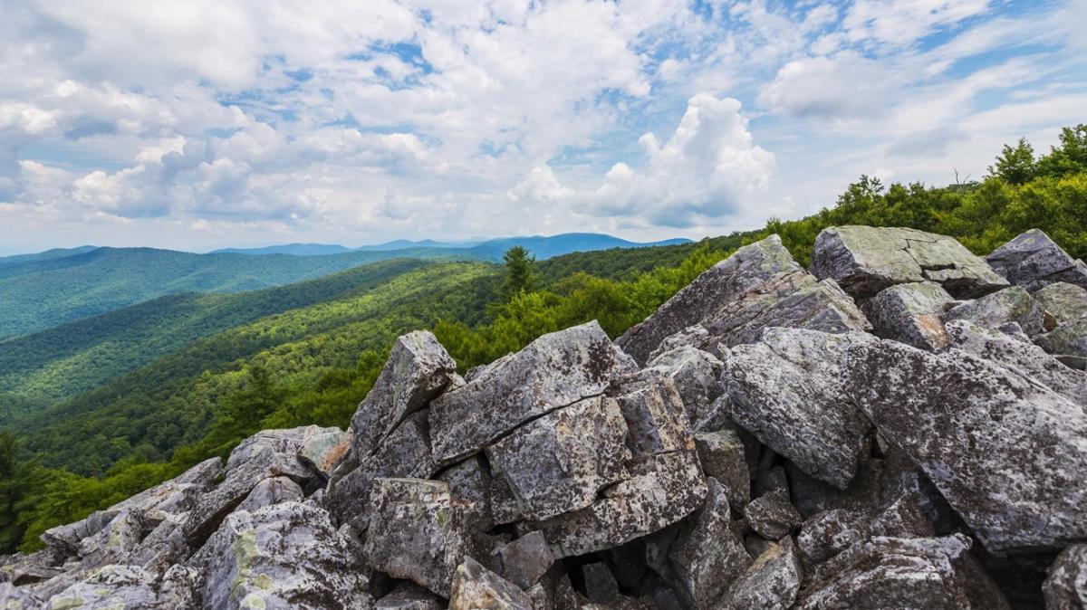 photo / NPS
• Distance: 1-mile circuit hike
• Location: South District (Mile 84.4)
• Difficulty: Easiest
• Hiking Time: 45 minutes
• Elevation Gain: 175 feet
• Pets Allowed: Yes (must be on a leash no longer than 6 feet at all times)
The Blackrock Summit Hike leads to a viewpoint on top of a rocky talus slope with sweeping views of the Shenandoah Valley and Massanutten Mountain. This hike is designated as a TRACK Trail, featuring a self-guided brochure and informational sign that turn your visit into a fun and memorable experience for kids of all ages.
STORY OF THE FOREST
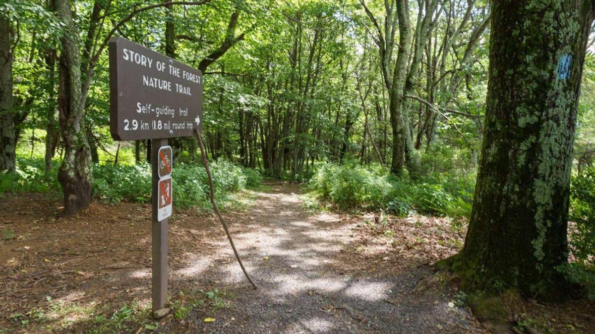 photo / NPS
• Distance: 1.8 miles roundtrip
• Location: Central District (Mile 51)
• Difficulty: Easiest
• Hiking Time: 1.5 hours
• Elevation Gain: 290 feet
• Pets Allowed: No
This easy family trail in the Big Meadows area of Shenandoah National Park is a 1.8-mile loop, with half of the trail paved. A great trail to spot Whitetail deer, the Story of the Forest Trail passes by the Big Meadows Air Quality Station, an important place for researchers to learn about air quality in Shenandoah.
LANDS RUN FALLS
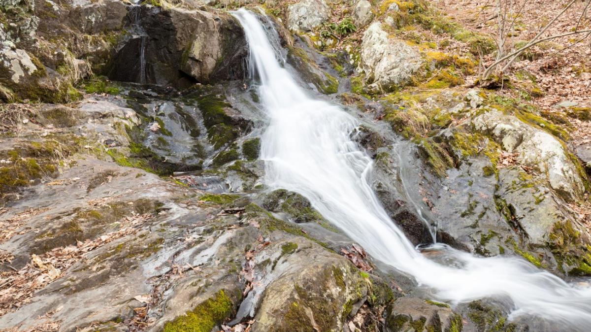 photo / NPS
• Distance: 1.3 miles roundtrip
• Location: North District (Mile 9.2)
• Difficulty: Easiest
• Hiking Time: 1.5 hours
• Elevation Gain: 325 feet
• Pets Allowed: Yes (must be on a leash no longer than 6 feet at all times)
The Land Run Falls are small but pretty, making them the perfect destination on an afternoon with little adventurers. The series of cascades descends about 80 feet into a gorge. Note that it may be waterless in dry seasons. A short hike down a fire road, the falls are a great place to explore, but use caution around the falls and rocky areas.
WHITE OAK FALLS (LOWER)
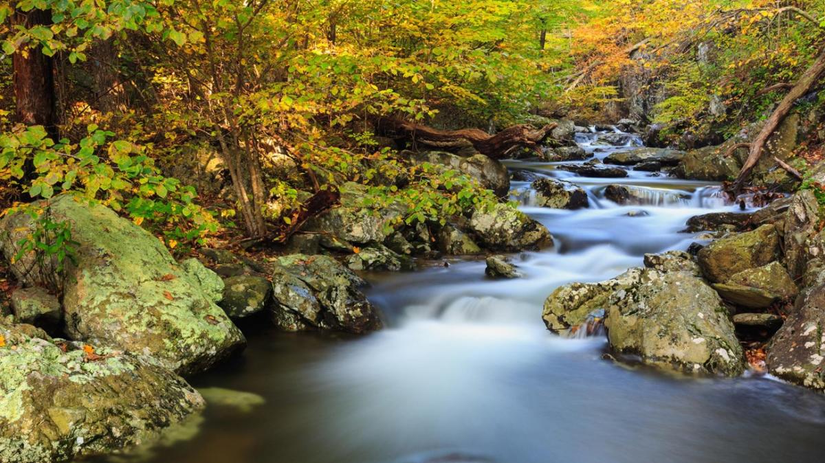 photo / NPS
• Distance: 2 miles roundtrip
• Location: Central District (Park Boundary)
• Difficulty: Easiest
• Hiking Time: 1.5 hours
• Elevation Gain: 500 feet
• Pets Allowed: Yes (must be on a leash no longer than 6 feet at all times)
Ranked as one of the park's most popular destinations, Whiteoak Canyon and its six waterfalls range in height from 35 to 86 feet, with swimming holes at th bottom of each waterfall. The lower falls are accessible by an easier hike to the base of the beautiful cascades.
FOX HOLLOW TRAIL
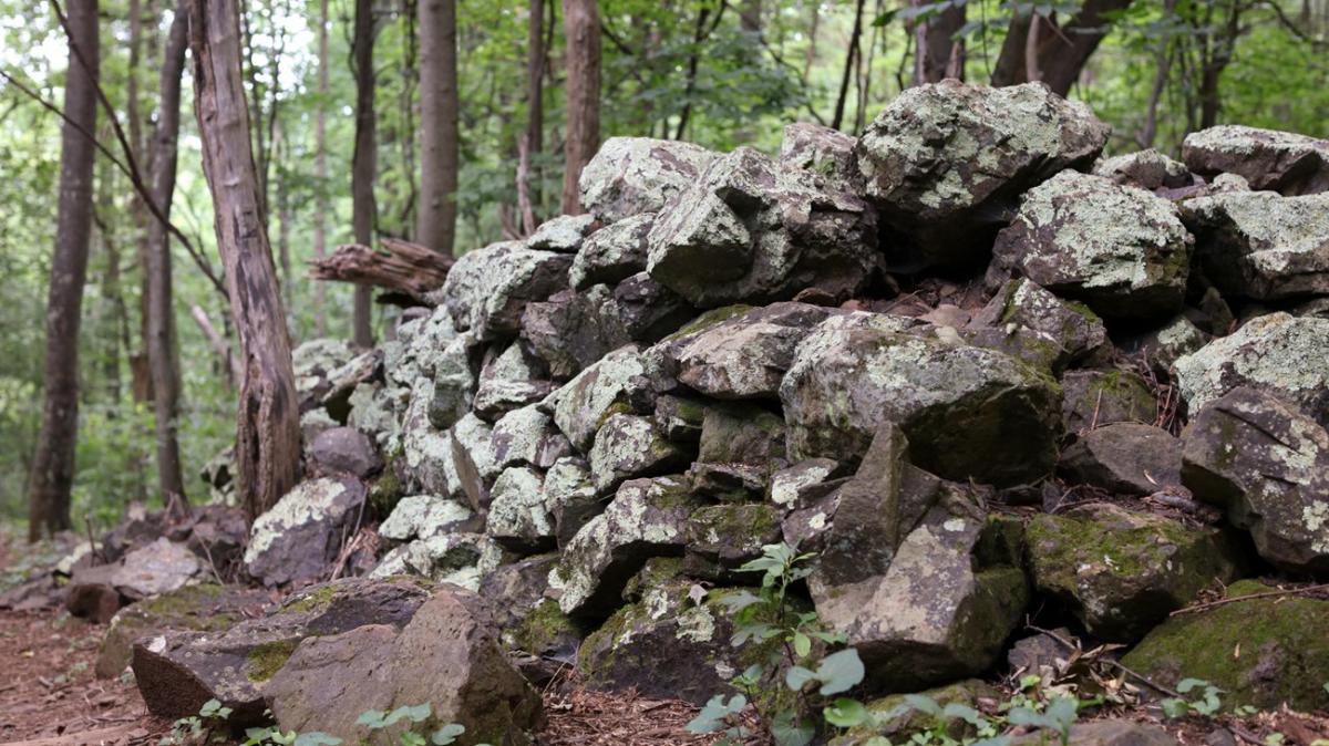 photo / NPS
• Distance: 1.2-mile circuit hike
• Location: North District (Mile 4.6)
• Difficulty: Easiest
• Hiking Time: 45 minutes
• Elevation Gain: 310 feet
• Pets Allowed: No
Discover the cultural history of the park as you pass by historic rock walls, a cemetery, and periwinkles planted by former residents during this 1.2-mile circuit hike along the Fox Hollow Trail. The hike is a designated TRACK Trail, featuring a self-guided brochure and informational sign that turn your visit into a fun and exciting outdoors experience for kids of all ages.
MILLERS HEAD
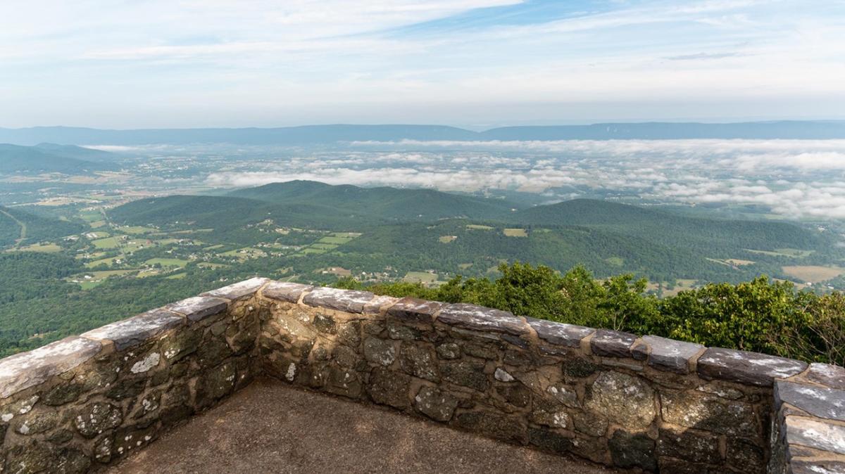 photo / NPS
• Distance: 1.6 miles roundtrip
• Location: Central District (Mile 42.5)
• Difficulty: Easiest
• Hiking Time: 2 hours
• Elevation Gain: 450 feet
• Pets Allowed: Yes (must be on a leash no longer than 6 feet at all times)
This hidden gem is one of several hikes near Skyland in Shenandoah National Park and is a good pick for tweens and older kids. The trail is rocky and the return is a bit steep. The hike leads to a spectacular viewpoint at the site of a former fire tower.
STONY MAN
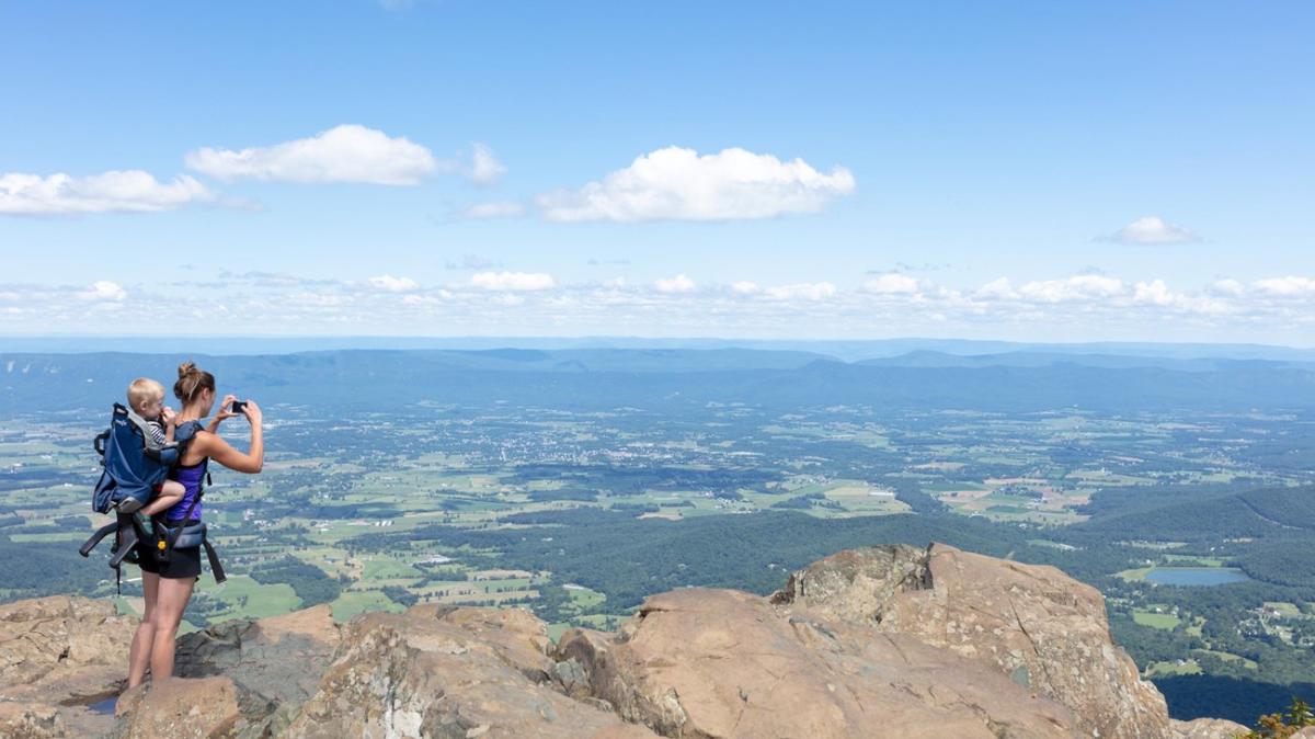 photo / NPS
• Distance: 1.6 miles roundtrip
• Location: Central District (Mile 41.7)
• Difficulty: Easiest
• Hiking Time: 1 hour
• Elevation Gain: 340 feet
• Pets Allowed: No
Discover this 1.6-mile loop trail leading to a stunning view of the Shenandoah Valley and Massanutten Mountain. The Stony Man hike is a popular area for birding, hiking, and running, so you'll likely encounter other people while exploring.
FORT WINDHAM ROCKS
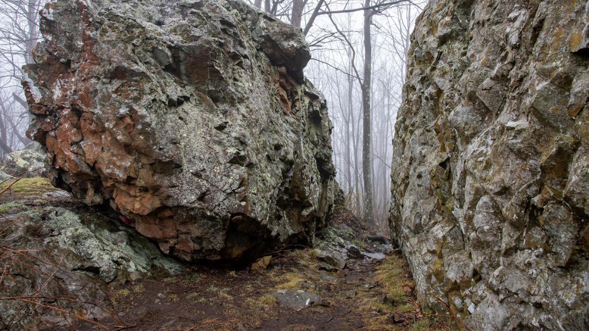 photo / NPS
• Distance: 0.8 miles roundtrip
• Location: North District (Mile 10.4)
• Difficulty: Easiest
• Hiking Time: 30 minutes
• Elevation Gain: 130 feet
• Pets Allowed: Yes (must be on a leash no longer than 6 feet at all times)
The short Fort Windham Rocks hike is a great option for little adventurers, with its lower elevation gain. The hike is along the Appalachian Trail and leads to a fascinating geologic feature: deeply split boulders rising 50 feet above the ground.
LIMBERLOST
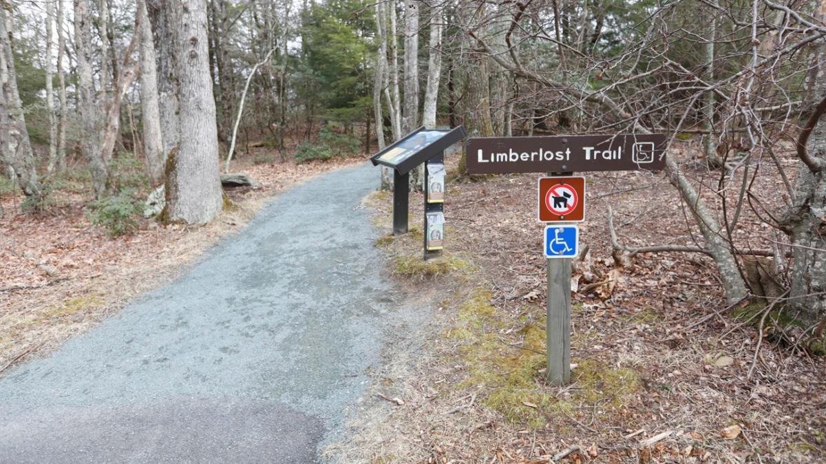 photo / NPS
• Distance: 1.3-mile circuit hike
• Location: Central District (Mile 43)
• Difficulty: Easiest
• Hiking Time: 1.5 hours
• Elevation Gain: 130 feet
• Pets Allowed: No
The Limberlost hike is a fully accessible trail, and although pets are not allowed on Limberlost, service animals are welcome. The 1.3-mile loop is built for visitors of all ages and abilities, winding through sprawling mountain laurel, tall oaks, and feathery ferns. It's also a designated TRACK Trail, featuring a self-guided brochure and informational sign that turn your visit into a fun and exciting outdoors experience for kids of all ages.
ACCESSIBILITY INFORMATION
Length: 2338.3 yards/2138.1 meters
Surface Type: primarily crushed greenstone
Typical Tread Width: 5 feet/1.5 meters
Minimum Tread Width: 2.7 feet/.8 meters
Typical Running Slope: 3.5%
Maximum Running Slope: 10.3%
Typical Cross Slope: 1.6%
Maximum Cross Slope: 5.0%
TRACES TRAIL
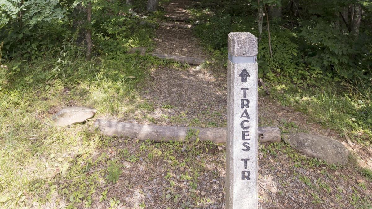 photo / NPS
• Distance: 1.7-mile circuit hike
• Location: North District (Mile 22.2)
• Difficulty: Easiest
• Hiking Time: 1 hour, 15 minutes
• Elevation Gain: 333 feet
• Pets Allowed: Yes (must be on a leash no longer than 6 feet at all times)
The Traces Trail hike follows a route around Mathews Arm Campground. Along the way, you'll see traces left behind by former residents of the area. The trail is a popular area for camping and hiking.
APPALACHIAN TRAIL — TANNERS RIDGE ROAD
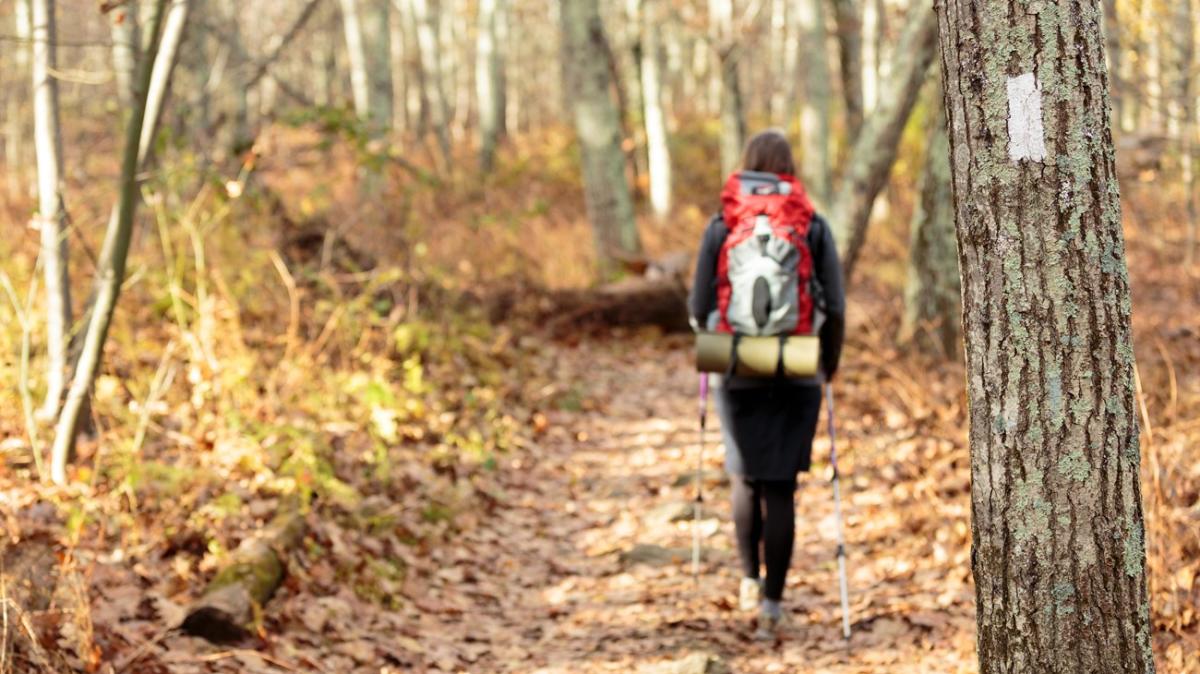 photo / NPS
• Distance: 2.1 miles roundtrip
• Location: Central District (Mile 52.8)
• Difficulty: Easiest
• Hiking Time: 1.5 hours
• Elevation Gain: 175 feet
• Pets Allowed: Yes (must be on a leash no longer than 6 feet at all times)
This 2.1-mile out-and-back trail near the Town of Stanley is considered an easy route, with an average completion time of less than an hour. The fairly level hike takes you through a former homestead on the renowned Appalachian Trail.